Dzukou Valley Trek Guide: Manipur–Nagaland Border’s Hidden Gem (a very real, very Indian take)#
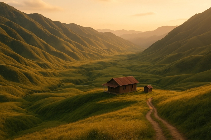
If there’s one trek in the Northeast that keeps pulling folks back, it’s Dzukou. Ask any North East trekker gang in Kohima or Imphal, they’ll say the same thing: those rolling green waves, the mist that sort of floats like it’s lazy, and that hush. It’s dramatic without trying too hard, you know? Dzukou sits on the Manipur–Nagaland border at around 2400-ish meters, and on a clear morning the valley looks like someone ironed God’s green bedsheet and laid it out for picnics. Then suddenly clouds barrel in and… everything disappears. Then it’s back again. Honestly, the mood swings are part of the charm.
Where exactly is Dzukou and what’s the vibe?#
Dzukou Valley stretches between Nagaland and Manipur, with most trekkers approaching from the Nagaland side via Kohima. You’ve got two main trails there — Viswema (easier gradient, a bit longer) and Jakhama (steeper, shorter, legs cry sooner). There’s also a Manipur-side entry that starts near Mao/Senapati and the Mount Iso belt, quieter but slightly trickier logistics. The valley itself is managed with a lot of care by local community bodies, especially the Southern Angami Youth Organisation (SAYO) on the Nagaland side, who’ve kept a firm grip on trash, fires, and general discipline. Thank god for that. It’s still rugged, but not the rowdy kind of rugged.
Best time to go (and when not to, unless you’re extra)#
- Late June to July: monsoon arrives, and this is when the famed Dzükou lily blooms. Trails are slippery, leeches do software updates and become super active, but the valley looks unreal. Carry salt, a sense of humour, and patience.
- August–September: lush green, streams gurgling, rains easing off a bit. Honestly the sweet spot for scenery vs slush.
- October–November: crisp skies, golden-brown grass begins, views galore. Nights get cold.
- December–January: sub-zero nights possible, frost, sometimes ice sheets in the streams. Fewer people, dramatic skies. But do not underestimate the cold — proper insulation or you’ll regret life choices.
- February–April: shoulder season, weather fairly stable, valley turns more straw-gold. Good time if you want peace minus rain drama.
Avoid peak heavy rains when there are landslide warnings or if the valley authorities temporarily restrict entries for safety. Also, in very dry spells, wildfire risk is real — follow local advisories strictly. As of the last year or so, authorities have been quick to close the trail if conditions go sideways, which is a good thing tbh.
Permits, fees, and those tiny but important rules#
- ILP: For Indian citizens, Inner Line Permit is required to enter Nagaland. You can apply online (Nagaland ILP portal) or get it at designated counters like Dimapur/Kohima — carry Aadhaar, ID pics, and give yourself some buffer time. Manipur also has ILP in place for domestic travellers; if you’re entering from that side, check the latest counters and categories before you start. Foreign nationals: rules have evolved; most can visit Nagaland without a PAP now but must register — still, pls check the latest official advisory because it changes, and nobody likes being stuck at a checkpoint.
- Valley entry fee and camera fee: there’s a conservation/entry fee collected near the trailhead or valley rest house. They sometimes separate rates for locals, domestic tourists, and foreigners. Keep cash; UPI might or might not work — network ka mood swings.
- Drones require permission. Fires are strictly controlled. Littering attracts fines (and well-deserved side-eye). Camping is only allowed in designated zones near the rest house; random tenting in the meadows is a no-no now.
Choosing your route: Viswema vs Jakhama vs Manipur side#
- Viswema trail (Nagaland): The “easier” one. From Kohima you head towards Viswema village; shared taxis go up to the last motorable point depending on road condition. There’s a steep stair-like ascent at the start (people jokingly call it the stairway to heaven and also to knee pain), then a long, gently undulating traverse to the valley. Most first-timers pick this route. 5–7 hours for average pace with breaks.
- Jakhama trail (Nagaland): Shorter and steeper, great if you’re fit and want to push. Some sections are rocky and tree-rooty. Going up Jakhama and coming down Viswema is a popular combo so your knees don’t riot.
- Manipur side (Mao/Senapati): More serene, fewer people. Logistics are a tad harder, but the views and solitude are something else. If you’ve got a local contact or guide, this side is magic. Time depends on trail conditions; rains change the game.
How to get there: transport that actually works#
- Base city: Kohima (Nagaland) for the popular approach. Fly to Dimapur or Imphal. From Dimapur, shared Sumo or bus to Kohima in 2–3 hours if the highway behaves.
- Kohima to trailhead: Shared taxis or local Sumos towards Viswema/Jakhama. Costs vary but budget around Rs 150–300 per seat; if you hire a small car it may run 1500–2500 one way depending on season and your bargaining luck. Start early, roads can get jammy near town.
- Manipur approach: From Imphal, take a shared Sumo to Senapati/Mao (around 2–3 hours). From there you may need a local taxi to the trail start. Network your way through — locals are super helpful when you ask nicely, bhai-style.
Where to stay up top (and what it’s really like)#
There’s a basic trekkers’ rest house on the ridge/valley side run with community oversight. Dorm-style rooms, simple wooden bunks, sometimes tents for rent, and very limited electricity if any. Nights are cold, and blankets get shared a lot — carry a sleeping bag if you can, thermal liner at least. Prices fluctuate, but think dorm in the Rs 300–600 range, tent rent extra, blankets can be charged separately if you take more. Food is basic and comforting: maggi, eggs, rice-thali types. Expect Rs 150–300 per meal range. Water is from streams; it’s clean-looking but use a filter bottle or puri tabs. Toilets are functional but minimal — this isn’t a glamping scene. Don’t expect hot showers. Expect stars, silence, and the occasional dog who decides you’re best friends.
Is it safe right now?#
Short answer: generally yes on the trek itself when it’s officially open, but always check recent local updates before you go. Weather can change super fast, and authorities sometimes close access briefly due to landslides, wildfires, or maintenance. Regionally, Northeast news can look intense sometimes — stay tuned to local advisories, keep your ILP/docs handy, and avoid roaming off marked trails. No need to be paranoid; just be sensible. Trek in daylight, stick with your group, and talk to the caretakers at the valley rest house for the latest on water levels and weather.
What to pack (don’t underthink this, yaar)#
- Footwear: grippy trekking shoes. Monsoon = leeches and slush, so ankle coverage helps. Carry leech socks if you’re squeamish, or just salt/Dettol.
- Layers: thermal base in winter, windproof shell, a fleece. Nights can go below zero in Dec–Jan. Even in October a cold wind can slap you silly.
- Rain gear: poncho or rain jacket with pants, plus a backpack cover.
- Sleep: light sleeping bag or liner; the blankets up there get fully booked.
- Lighting: headlamp, power bank, spare batteries. Electricity is fickle.
- Water: 1–2 litre bottles with a filter. Streams are beautiful but don’t trust blindly.
- Snacks: energy bars, chikki, dry fruits. Also carry your fav masala chai bags for that god-tier sunrise sip.
- Medical: personal meds, blister care, ORS, basic first aid. If you get altitude headaches easily, go slow, hydrate, avoid alcohol up there.
- Waste: reusable tiffin/cutlery, garbage bags. You pack it in, you pack it out. No debate.
The trek day by day (a doable 1N/2D sample plan)#
Day 0: Reach Kohima, sort your ILP if not done, buy supplies. Quick stop at Kisama Heritage Village if you have time — that’s the Hornbill Festival venue in early December.
Day 1: Early taxi to Viswema/Jakhama, start climb by 7–8 am latest. Reach the ridge by noonish if you’re steady, then another couple hours to the valley rest house. Dump the bag, grab tea, and do a light walk to the meadows if weather behaves. Sunset point on a clear day is ridiculous — the grass glows.
Day 2: Pre-sunrise chai, short stroll to the stream (watch your step on frosty rocks). Explore the valley floor, see the little wooden bridges, keep an eye out for the Dzükou lily patch if you’re in season (don’t trample, please). Head back by late morning, start descent by noon to beat mist and fatigue. If you came up Jakhama, descend via Viswema to vary your knees’ complaints. Get to Kohima by evening for legendary pork-with-bamboo dinner.
Food you should actually try nearby (Nagaland and Manipur both!)#
- Nagaland: smoked pork with axone (fermented soybean), bamboo shoot curries, sticky rice, and a sip of zutho (traditional rice drink) if you find a legit place. Also naga chilli chutneys — careful if you’re not used to the sting.
- Manipur: eromba (mash of veggies and fish with king chilli), kangsoi (light veg stew), singju (herb salad), and the iconic chak-hao kheer made from black rice. Street tea stalls are the best, not fancy cafés, just vibes.
Costs and budgeting (rough and honest)#
- Kohima stay: budget guesthouses/hostels around Rs 800–1500 per night for a clean bed. Mid-range 2000–4000. Prices spike during Hornbill.
- Transport (Kohima to trailhead return): shared seats 150–300 each way; private cab 2000–4000 return depending on season and wait-time.
- Entry + camera + stay: keep about Rs 600–1500 for fees+ dorm/blankets + basic meals up top. If you rent tents/sleeping bags there, add another 500–1000. All very ballpark.
- Food in town: Rs 200–400 per meal for regular joints. Fancy cafés in Kohima have bumped prices, coffee culture is on the rise.
All in all, a 2N/3D Dzukou plan from Kohima with one night up top and basic comfort can be done in Rs 6k–10k for most budget travellers if you share rides and keep it simple.
Network, cash, and those small gotchas#
- Network: patchy to none in the valley. On the ridge you may get stray bars (Jio often throws a tantrum, BSNL sometimes surprises). Download offline maps and tell fam you’ll be ghosting for a day.
- Cash: carry enough. UPI doesn’t always work at the rest house. Keep small change for tea and snacks.
- Timing: start early. Mist builds up after noon and messes with visibility.
- Weather: clouds roll in fast. If thunder starts, don’t be a hero standing on an exposed ridge.
- Shoes off politeness: at homestays and some rest houses, read the room. Northeast is big on etiquette — be polite, ask before doing the social-media thing.
Culture and sustainability (don’t just trek, respect)#
Dzukou sits on land that’s deeply tied to the Southern Angami people and communities across the border in Manipur. When folks ask you not to litter, not to light fires, not to stomp through meadows for that One Reel, it’s not being fussy — it’s life and livelihood. Pack out trash, avoid blasting music, ask before flying drones. You’ll see regular cleanup drives led by local youths; join if you cross paths — it’s wholesome and also humbling. And please do not pick flowers. Dzükou lily exists here and a few nearby pockets, let it live to see another monsoon.
Trending now: Hornbill + Dzukou combo, and shoulder-season bliss#
Pairing the early-December Hornbill Festival in Kisama with a Dzukou trek is honestly the most common plan these days. Accommodation prices shoot up in Kohima, but the energy is unreal — music, tribe showcases, food stalls, archery, the works. If you’re crowd-averse, try late Oct–mid Nov or late Feb–March instead. Another trend: people going mid-week to avoid weekend crowding, and sunrise treks starting very early to get the valley to themselves for an hour. Pro tip that’s not a secret anymore.
Common mistakes people make (and how to not do them)#
- Underpacking warmth: even non-winter months can whip up a cold wind. Bring a fleece, stop arguing.
- Late start: you hit the steep bits at noon, the sun decides to grill you, and by 2 pm the mist says hello darkness my old friend.
- Overreliance on UPI: carry cash. And not just 200 rupee, take a mix.
- New shoes on trek day: blisters and regret. Break them in.
- Chasing drone shots without permission: invites trouble and fines. Don’t.
- Leaving camp area for “secret camping”: there’s a reason zones are marked. Wildfire history is real, and the grassland is delicate.
If you’re going in peak monsoon (you brave soul…)#
Just accept you’ll get wet. Wear quick-dry layers, keep phone in a dry pouch, and take trekking poles for slippery sections. Leeches? Dab salt or Dettol, flick them off, and don’t panic — more gross than dangerous. Keep socks long, shoes snug, and do not stop on soggy slopes for long breaks. Trails can turn to chocolate pudding; move steadily and be super mindful on descents. The reward is a valley so green it almost hurts the eyes — and those lilies blooming like they own the place.
A small sample daypack checklist (won’t fail you)#
- 20–30L backpack with rain cover
- 2L water + filter bottle
- Light snacks + a proper lunch if you’re slow eaters like me-and-everyone
- Rain jacket/poncho
- Warm layer (fleece)
- Cap + gloves in colder months
- Headlamp
- Power bank
- Personal meds + basic first aid
- ID, permits, cash in a ziplock
- Trash bag (carry your wrappers back, easy na?)
Photography notes, for the gram but with sense#
Golden hour just after sunrise lights up the grassy folds like waves. Mist shots are luck-based — wait 10 minutes and the entire scene can change. Keep distance from stream edges in winter (ice is sneaky). If you’re shooting people, ask first — locals are chill but consent is cool, always. And please, no trampling off-trail into meadows for a wider angle; use the footpaths, the place heals slow.
Quick FAQ, because everyone asks these#
- Difficulty: Easy-moderate if you’re somewhat fit. The initial climb is sweaty business; after that it’s cruisy.
- Can beginners go? Yep. Go slow, carry layers, hydrate. It’s not Everest, relax.
- Solo ok? Yes if you’re confident and sensible. But teaming up is smarter in mist or winter.
- Kids/parents? Teens okay if used to walks. Elderly folks should assess the first climb; it’s steep. No shame turning back if needed.
- Connectivity? Patchy to none in the valley.
- Wild animals? Mostly birds, rodents, and occasional barking deer nearby. Respect distance, no feeding. The biggest risk is weather and your own decisions.
Final notes on responsible travel (and a little nudge)#
Dzukou’s popularity has exploded these past few years, and while that’s great for local income, it also means more pressure on trails and water. If you can, carry your own steel tiffin and spoon, skip single-use plastics, and tip fairly for services up there — caretakers work hard to keep that place clean and safe. Listen to instructions, even if they sound strict. That quiet you feel in the valley? It’s maintained, not accidental.
Wrap-up: why Dzukou sticks with you long after you leave#
There are prettier lakes, taller peaks, longer treks. But Dzukou… it’s the calm. It’s the way clouds brush the slopes, how the bamboo grass sways like ocean ripples, and how small you feel without feeling scared. It’s one of those Northeast places that makes you slow down. Whether you go in lily-season, winter frost, or that perfect post-monsoon glow, treat it gently and it’ll pay you back a hundred times in memories you can’t quite put into words. If you’re planning it soon, double-check ILP rules and local advisories — they update every now and then, even into 2025 and beyond. And if you want more down-to-earth travel stories and no-nonsense guides, I keep finding solid stuff on AllBlogs.in — worth a browse before your next trip.


