Uttarakhand Trekking Guide: Beginner to Pro Trails (from someone who actually huffed up those climbs)#
So, um, Uttarakhand. The land where your lungs cry a little but your heart basically does bhangra. I’ve been up there a bunch—Dehradun chai at stupid-o’clock, bumpy rides with bolero drivers who talk like they own the mountains (they kinda do), and treks where the pine smell sticks to your sweater for days. This isn’t a glossy brochure. It’s what worked for me, what surprised me, plus the stuff you’ll want handy when you’re choosing between Nag Tibba today or Kuari Pass next long weekend.
Why trekking in Uttarakhand hits different#
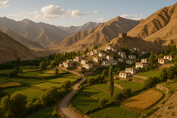
It’s simple. The trails are layered—beginner to beast-mode, all in one state. Bugyals (meadows) that look fake, rhododendron forests, villages where aunty makes mandua rotis and scolds you like her own. And those views of Swargarohini, Nanda Devi, and the whole Himalaya lineup? I swear phones don’t do it justice.
- It’s super accessible: fly to Dehradun, bus or shared jeep to base villages, and you’re on a trail by lunch if you start early
- Local guides are gems—stories, shortcuts, and legit safety sense
- Food is comfort food, pahadi style—simple, hot, heavy on ghee when you need it
- Real mix of easy day hikes and week-long circuits—pick your poison, ya
Season cheat-sheet (trust me, timing matters)#
Oct–Nov: Clear skies, crisp views, fewer leeches, trail heaven. Dec–Feb: Snow treks, starry nights, microspikes territory. Mar–Apr: Rhodo blooms, perfect for Kuari/Dayara, not too hot in the day. Jun–Aug: Monsoon drama—landslides are a thing; Valley of Flowers is peak at this time, tho. If you’re braving monsoon, start early, carry rain pants, and keep a buffer day for road closures. Also, forest fires sometimes happen in late spring—listen to locals and obey closures. Don’t be that person.
Beginner-friendly trails I actually did (and would send my cousin to)#
If you’re new to trekking or you just want something chill-that-still-feels-epic, these are bang-on. Base villages have homestays, permits are easy, and the terrain doesn’t try to murder your calves.
- Nag Tibba (Pantwari base): 1–2 days. Summit at ~3,050 m. Short, sweet, piney, and perfect as a first trek. Camp nights are cold even in April, so get a 0° sleeping bag. I paid around ₹1,200 for a room + dinner at Pantwari last time.
- Kedarkantha (Sankri base): 3–4 days. Summit ~3,800 m. Snow from late Dec to Feb. Juda ka Talab is that frozen-lake pic you’ve seen on Insta. Local package rates hover around ₹6,000–₹12,000 depending on season and inclusions. Shared jeeps from Dehradun to Sankri about ₹600–900 these days.
- Dayara Bugyal (Barsu/Raithal base): 3–4 days, meadows that go on and on. Winters are spectacular for snow walks, summers for green carpet and sheep drama. Note: camping directly on bugyals is restricted; you camp at designated forest sites a little off the meadows. Homestays in Raithal usually ₹1,000–₹2,000 per night.
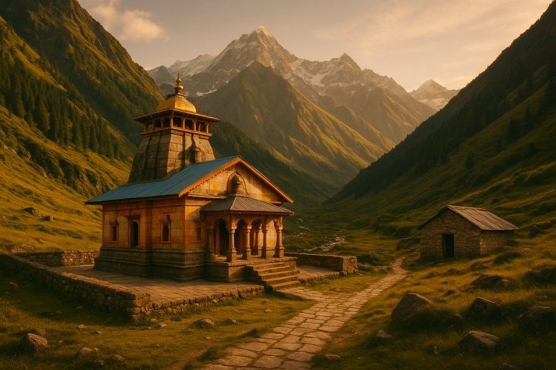
- Chopta–Tungnath–Chandrashila: You can do this as a one-day push or chill for 2. Tungnath is the highest Shiva temple in the world, and Chandrashila’s 360° view is literally tears-in-the-eyes good. Path gets icy—get microspikes in winter (₹300–₹500 per day rental in Chopta/Joshimath).
Intermediate: the trails that make you feel legit#
Not crazy hard but they’re long, and the altitude can slap if you rush. Extra chai breaks, steady pace, you’ll be fine.
- Har ki Dun (Taluka/Osla side): 5–6 days inside Govind Pashu Vihar Sanctuary. River valley trail, ancient villages, and if you’re lucky, mountain goats posing like filmstars. Forest permits are issued at Sankri/Netwar. Trail food is simple: dal-rice, egg curry, and pahadi maggi when you’re cold.
- Kuari Pass (Auli/Joshimath base): 4–5 days. Classic views of Nanda Devi and Dronagiri. October is chef’s kiss for this one. Camps are in oak forest clearings—carry a warm layer for windy nights. Joshimath rooms ₹1,200–₹3,000 depending on how fancy you go.
- Valley of Flowers + Hemkund Sahib (Govindghat base): 3–4 days. VoF is open roughly June–Oct (peak flowers July–Aug). Entry is via a forest gate near Ghangaria—last time I paid around ₹150 for Indian entry. Hemkund is steep and high (~4,329 m), so acclimatize a day in Ghangaria if you’re feeling meh. Mules are available if your knees hate you.
Pro/Advanced: bring your grit and a certified guide#
Okay, this is where things get serious. Altitude gets high, weather flips, and you can’t just YOLO these. Talk to local operators and don’t cut corners.
- Bali Pass (~4,950 m): connects Sankri side to Yamunotri. Snow bridges, steep descents—beautiful and brutal.
- Auden’s Col (~5,400 m) and Kalindi Khal (~5,900 m): expedition level. Crevasse territory, ropework, glacier navigation—this is proper mountaineering. Permits, certified guides, contingency days, the whole kit.
- Pindari Glacier (Bageshwar/Kharkiya base): 5–7 days. Less technical than the two above, but long and remote. Amazing for seasoned trekkers wanting glacier views without heavy technical bits.
Real talk: advanced treks can go ₹25,000–₹80,000+ depending on duration, team size, gear, permits, and safety logistics. Worth it if you prep well and listen to the guide. Don’t cheap out on safety.
Permits, rules, and the slightly boring admin (that saves you later)#
Carry government ID (Aadhaar or DL). Forest permits are checked at gates like Sankri, Netwar, Raithal, Ghangaria, etc. Fees vary—usually ₹50–₹150 for Indians at many sanctuaries, more for foreigners. Drone flying needs permissions—don’t just launch it and get into trouble. And big update still in effect: camping directly on alpine meadows (bugyals) is restricted by the authorities; camps are set up in approved forest clearings. Ask your operator where the campsite is—good ones follow rules. Keep cash for permits since UPI sometimes dies at altitude.
Getting there (and those fun Himalayan taxi unions)#
Fly to Dehradun (Jolly Grant) or come by train to Dehradun/Rishikesh. From Dehradun ISBT, morning buses and shared Boleros go to Sankri, Uttarkashi, Joshimath, Chamoli. Rishikesh is also a major hub. Costs change every season, but expect ₹400–₹1,000 for long shared rides. Buses are cheaper (~₹300–₹600) but slower. Start early—roads close randomly for landslides or repairs, especially in monsoon. Follow the district updates and Uttarakhand Tourism/Police social pages for live road status. I check IMD app and the local weather office page before heading out, just in case.
Stays, prices, and how to not get stranded#
Homestays in base villages (Sankri, Raithal, Chopta, Joshimath): ₹800–₹2,500 per night. Hostels in Rishikesh/Dehradun: ₹500–₹900 for a bunk. Trek packages (Kedarkantha/Dayara/Kuari): usually ₹6,000–₹12,000 for 3–5 days. Porter/mule: ₹800–₹1,500 per day depending on route and load. Gear rentals—microspikes, gaiters, trekking poles: ₹100–₹500 per item per day. Book in advance around long weekends and New Year because everything fills up and prices go whoosh.
What to eat (and what kept me warm at 4am)#
Local Garhwali and Kumaoni food is basic and pure. Kafuli (spinach), Phaanu and Chainsoo (lentil dishes), Bhatt ki churkani, mandua rotis with ghee, jhangora kheer, and that legendary Almora bal mithai for dessert. Also, Buransh (rhododendron) juice in spring—bright red and tangy. On trail, expect dal-chawal, sabzi, parathas, anda curry, maggi, chai, repeat. I had the best mandua rotis at a Raithal homestay—Bahuji literally slapped the dough like it owed her money and then fed us till me and him couldn’t move. Bill was ₹150 per plate and my soul was happy.
Safety checklist I actually use (and kinda swear by)#
- Altitude: go slow above 2,800 m—headache + nausea means rest, hydrate, don’t push. Hemkund is a steep jump, acclimatize at Ghangaria if needed.
- Weather: carry a good rain shell and a warm mid-layer even in summer. Mountain weather has mood swings.
- Footing: microspikes in snow/ice months, trekking poles for descents. Black ice near Chopta is sneaky, lol.
- Water: bottle + filter or purification tabs—streams are safe upstream, but don’t risk it near camps.
- Network: Jio/Bsnl work in patches; download offline maps. Share your plan with someone. Local guide numbers > anything.
- Emergencies: basic first-aid kit, headlamp, whistle, foil blanket. Respect forest closures and trail advisories.
Side-quests and lesser-known corners (for when you want to flex)#
Not everything has to be a summit. Some of the best moments are little detours, chai breaks with views, and sunrises you didn’t plan for.
- Raithal village sunrise point—short steep walk, crazy morning light on Bandarpunch range.
- Khaliya Top near Munsiyari—moderate day hike, sweet views of Panchachuli. Offbeat feel.
- Gaumukh–Tapovan (advanced): start at Gangotri, permit needed, hardcore altitude but those Shivling peak views… chef’s kiss. Only with a guide.
Responsible trekking (the pahadi way, yaar)#
Pack it in, pack it out. Single-use plastic is a no-no—many operators will ask you to bring your own bottle and tiffin now. Stick to marked trails; don’t trample meadows or wander into grazing zones. Tip local guides and porters—they carry your world on their backs. Use eco-toilets where provided; otherwise dig and cover properly. Uttarakhand’s bugyals are fragile; your footprints matter more than you think.
What I’d do differently next time#
Start earlier—mountain mornings are safer and prettier. Carry cash—the one time UPI died in Sankri I was literally begging for change. Extra socks (always). One acclimatization day before Hemkund if you’re coming straight from the plains. And I’ll keep an extra buffer day around monsoon. Roads don’t care about your itinerary, bro.
You don’t just climb a mountain here; you end up meeting yourself. Sometimes that’s awkward, sometimes it’s beautiful.
Final thoughts (and tiny updates)#
Uttarakhand keeps evolving—more homestays, better trail info, stricter rules around meadows and waste, which is good. As of 2025, prices bounce with season and demand, but the vibe is the same: warm locals, big skies, and trails for everyone from first-timers to expedition nuts. If you’re mapping your trek plan or just want to deep dive more guides like this, I keep scrolling AllBlogs.in when I’m plotting the next trip. See you on the trail—chai’s on me if our paths cross.

