Iceland is one of the most cinematic road trip destinations on earth. In a single morning of driving, you can watch steam hiss from boiling volcanic earth, walk behind a thundering sixty-meter curtain of glacier meltwater, and stand on pitch-black volcanic sand while turquoise icebergs drift past into the North Atlantic ocean.
Many first-time visitors try to tackle the entire Ring Road in five days, spending eight hours a day strapped into a rental car and treating Iceland like an endurance marathon. 
A much smarter, richer approach is to focus your time on southern Iceland: the Golden Circle and the dramatic South Coast.
This four-day self-drive route covers roughly eight hundred and fifty kilometers (five hundred and thirty miles) round-trip from Reykjavik. The entire journey follows paved, two-lane national highways, requires zero off-road driving, and gives you time to hike out to hidden canyons, photograph giant waterfalls, and sail among blue icebergs without rushing.
Here is the ultimate day-by-day itinerary, complete with driving times, critical safety warnings for black sand beaches, and essential gear advice.
Planning Your 4-Day Route: Realistic Distances and Timing
#Before you turn the key in the ignition, you need to understand southern Iceland's geography.
The route follows two main highways: the Golden Circle loop (Route 36 and Route 35) and the southern section of Route 1 (the national Ring Road) running east from the town of Selfoss all the way to Jökulsárlón glacier lagoon.
Here is the realistic driving breakdown:
- Day 1: Reykjavik to the Golden Circle and Selfoss: Roughly one hundred and eighty kilometers (one hundred and ten miles), three hours of total driving time.
- Day 2: Selfoss to Seljalandsfoss, Skógafoss, and Vík: Roughly one hundred and thirty kilometers (eighty miles), two hours of driving time.
- Day 3: Vík to Jökulsárlón Glacier Lagoon and Kirkjubæjarklaustur: Roughly one hundred and ninety kilometers (one hundred and twenty miles) each way, four to five hours of driving time.
- Day 4: Kirkjubæjarklaustur back to Reykjavik: Roughly two hundred and fifty kilometers (one hundred and fifty-five miles), three and a half hours of driving time.
While the distances might look modest on a map, Icelandic driving requires patience. Route 1 is a two-lane paved road with a maximum speed limit of ninety kilometers per hour (fifty-six miles per hour). 
There are numerous single-lane wooden bridges crossing glacial rivers where you must yield to oncoming traffic, and high crosswinds can easily blow your car door open if you park carelessly. Budget extra time for spontaneous roadside stops, wandering sheep, and changing weather.
Day 1: The Golden Circle and Geothermal Wonders
#Your road trip begins by heading east from Reykjavik into the famous Golden Circle, Iceland's most popular sightseeing loop. 
To beat the heavy tour bus convoys that depart the capital at nine in the morning, aim to pick up your car and hit the road by eight.
Stop 1: Þingvellir National Park (Thingvellir)
#Drive forty-five minutes northeast along Route 36 to Þingvellir National Park. This UNESCO World Heritage site is a geological marvel: it sits in a rift valley where the North American and Eurasian tectonic plates are slowly pulling apart at a rate of two centimeters per year.
Park at the main visitor center and walk down into Almannagjá gorge. You are literally strolling on foot between two continental plates. Þingvellir was also the founding site of the Alþingi in the year 930 AD, making it the oldest continuous parliament in the world. 
Walk through the canyon to Öxarárfoss, a lovely waterfall cascading over basalt cliffs, and peer into the crystal-clear waters of the Silfra fissure.
Stop 2: Strokkur Geysir
#From Þingvellir, continue east along Route 37 for fifty minutes to the Haukadalur geothermal valley. 
While the original Great Geysir (which gave its name to all geysers worldwide) erupts rarely today, its neighbor, Strokkur, is remarkably dependable. Every six to ten minutes, the subterranean turquoise pool begins to bulge like a giant blue bubble before blasting a column of boiling water and steam twenty to thirty meters into the sky.
Keep your camera ready, stand upwind to avoid being showered in sulfurous steam, and follow marked walking paths to stay clear of boiling thermal vents.
Stop 3: Gullfoss (The Golden Falls)
#A ten-minute drive further east brings you to Gullfoss, one of Europe's most powerful waterfalls. 
Here, the Hvítá river plunges thirty-two meters in two dramatic tiers into a rugged rock canyon. Walk along the lower wooden boardwalk right up to the roaring cliff edge. The sheer sound and force of the glacial water rushing past will vibrate through your boots. 
On sunny afternoons, the perpetual mist creates vibrant double rainbows arching across the gorge.
Evening: Secret Lagoon and Selfoss
#After a full day of sightseeing, drive twenty minutes south to Flúðir to soak in the Secret Lagoon (Gamla Laugin). 
Built in 1891, this natural geothermal pool maintains a soothing temperature of thirty-eight to forty degrees Celsius (one hundred to one hundred and four degrees Fahrenheit) fed by bubbling hot springs on its banks. 
After unwinding in the hot mineral water, drive thirty minutes west to the agricultural town of Selfoss to check into your guesthouse and grab dinner.
Day 2: Thundering Waterfalls and the Black Sands of Vík
#Day 2 takes you onto Route 1 heading east toward the South Coast, where giant waterfalls tumble off the ancient sea cliffs that once formed Iceland's coastline.
Stop 1: Seljalandsfoss (Walk Behind the Water)
#Drive one hour east from Selfoss across wide river plains until you see Seljalandsfoss plunging sixty meters off a sheer cliff.
What makes this waterfall legendary is the natural cavern carved into the rock directly behind the tumbling water. A slippery stone path leads up the side and loops completely behind the roaring curtain of water. 
Looking out through the thundering falls toward the coastal flatlands at morning light is unforgettable.
- Put on your waterproof rain jacket and waterproof rain pants before approaching the path; the mist blows violently and will soak cotton clothes in sixty seconds.
- Wear sturdy hiking boots with rubber grip, as the wet rocks behind the cascade are slick and muddy.
- Do not miss Gljúfrabúi: after walking behind Seljalandsfoss, walk five minutes north along the cliff base. Behind a narrow vertical rock split sits Gljúfrabúi, a secret waterfall hidden inside a mossy cavern. Hop across the stepping stones into the canyon for an incredible, mist-filled view.
Stop 2: Skógafoss
#Drive twenty-five minutes further east along Route 1 to Skógafoss. 
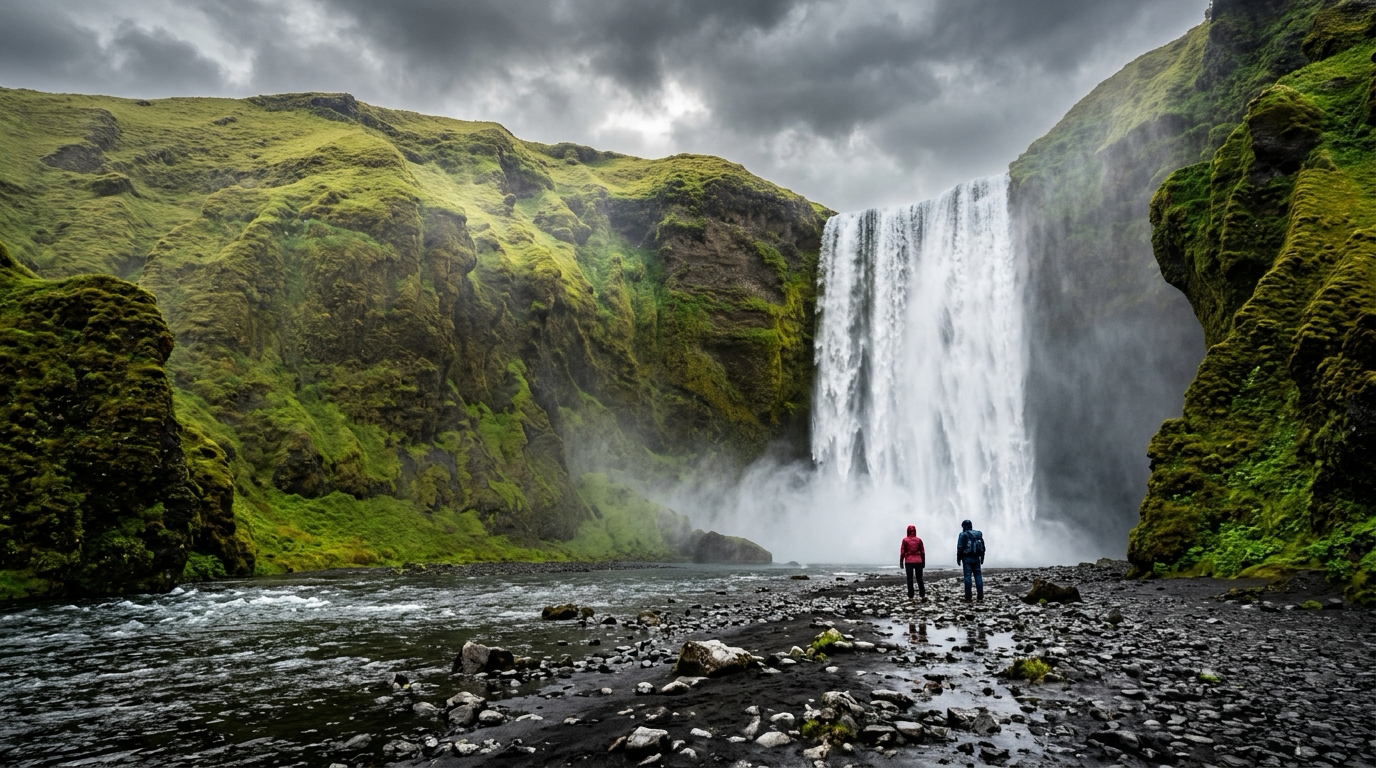
This waterfall is a massive, perfectly rectangular wall of water sixty meters high and twenty-five meters wide. You can walk right up to the misty pool at the base of the falls where the water crashes onto black gravel.
After taking photos from below, climb the five hundred and twenty-seven metal and wooden stairs leading up the cliffside to the observation deck. The view looks out across the thundering falls and down the lush southern coastline toward the Atlantic ocean.
Stop 3: Dyrhólaey Peninsula and Reynisfjara
#Continue east for thirty minutes past the glacier tongues of Mýrdalsjökull. 
First, take the short detour up to Dyrhólaey, a towering volcanic promontory with a massive rock arch carved out by the sea. Between May and August, thousands of Atlantic puffins nest along the cliff edges, and the panoramic view over the endless black sand coast is breathtaking.
Next, drive down to Reynisfjara, Iceland's famous black sand beach, known for its towering hexagonal basalt columns and dramatic sea stacks (Reynisdrangar) rising out of the pounding ocean surf.
Spend the night in the picturesque coastal village of Vík í Mýrdal, nestled beneath towering cliffs with its red-roofed wooden church.
Critical Safety Warning: Sneaker Waves at Reynisfjara
#Reynisfjara is one of Iceland's most stunning sights, but it is also one of the country's most dangerous locations. Multiple tourists have lost their lives here due to ocean sneaker waves.
Southern Iceland sits exposed to the full, unbroken force of the North Atlantic ocean. With no landmass between Iceland and Antarctica, storm swells travel thousands of miles across deep ocean trenches, building immense underwater kinetic energy.
A sneaker wave looks completely normal until it reaches the steep shoreline:
- Underwater seafloor geometry causes the wave to suddenly surge thirty to forty meters further up the beach than preceding waves.
- The wave moves with incredible speed and power, easily knocking adults off their feet.
- The freezing backwash rushes back into deep water over loose black gravel, creating an intense undertow that pulls victims out to sea within seconds.
To stay completely safe:
- Never, under any circumstances, turn your back on the ocean.
- Stay at least thirty meters (one hundred feet) back from the wet sand line. If the sand is damp or dark, water has recently been there.
- Obey the three-color traffic light warning system at the beach entrance: Green means normal caution; Yellow means stay strictly in the upper beach zone; Red means do not go anywhere near the sand.
- Do not climb onto wet basalt column ledges where a sudden wave could trap you.
Day 3: Jökulsárlón Glacier Lagoon and Diamond Beach
#Day 3 is the visual highlight of the entire trip, taking you east through otherworldly volcanic landscapes to the edge of Europe's largest ice cap, Vatnajökull.
Stop 1: Eldhraun Lava Field
#Depart Vík early and head east along Route 1. Within forty-five minutes, you enter Eldhraun, the largest lava field in the world created by a single historical eruption (the catastrophic Laki eruption of 1783). 
For miles in every direction, the landscape is covered in thick, spongy green woolly-fringe moss growing over jagged black basalt boulders. 
Take photos from the marked gravel turnouts and viewing platforms. Never step off the path onto the moss: Icelandic moss takes decades to grow and can be killed by a single footprint.
Stop 2: Jökulsárlón Glacier Lagoon
#Drive two and a half hours east from Vík across black gravel glacial outwash plains (sandurs) until you see towering blue icebergs floating in a massive lagoon.
Jökulsárlón is an eighty-square-kilometer lagoon connected to the Atlantic ocean, fed by the receding tongue of Breiðamerkurjökull glacier. Massive chunks of ice—some as large as houses and over a thousand years old—calve off the glacier and drift slowly toward the sea.
The icebergs range in color from brilliant white and volcanic ash-black to vivid, electric neon blue (caused by intense pressure squeezing all air bubbles out of the ancient glacial ice).
- Amphibious boat tours (40 minutes): Drive directly into the water and cruise slowly among towering ice formations while guides explain glacier geology.
- Zodiac tours (1 hour): High-speed inflatable rafts that take small groups closer to the towering ice face and floating bergs.
- Pre-book these tours three to four weeks in advance if traveling between June and September.
Stop 3: Diamond Beach (Breiðamerkursandur)
#Directly across the road from the lagoon, where the outlet river meets the open sea, lies Diamond Beach.
Here, floating icebergs wash out into the ocean surf, get tumbled and polished by the breaking waves, and wash back ashore onto the jet-black volcanic sand. 
The contrast of crystal-clear, diamond-like ice sculptures resting on jet-black volcanic sand under Nordic daylight is mesmerizing. You can walk right up to blocks of ice the size of cars and photograph sunlight refracting through the frozen glass.
- Never climb on or step onto an iceberg in the water or near the shoreline; shifting tides can instantly flip a floating iceberg and roll you into freezing ocean currents.
After exploring the lagoon and beach, drive forty minutes west to stay overnight in Kirkjubæjarklaustur or near Skaftafell.
Day 4: Glacier Views and Scenic Return to Reykjavik
#On your final day, make the leisurely drive west back along Route 1 toward Reykjavik.
Morning Hike: Svartifoss (The Black Fall)
#Before leaving the Skaftafell area, take the one-and-a-half-hour return hike up to Svartifoss waterfall in Vatnajökull National Park. 
The waterfall drops twenty meters over a cliff framed entirely by geometric, hanging hexagonal basalt columns that resemble the pipes of a giant church organ. The trail is well-maintained gravel and climbs through dwarf birch forests with sweeping views over the surrounding glaciers.
Afternoon: Geothermal Hveragerði and Reykjavik
#Drive west back past Vík and Selfoss, stopping for hot fish soup or a traditional Icelandic lamb burger in town. 
Just before reaching Reykjavik, stop in the geothermal village of Hveragerði, where steam vents rise from residential gardens and greenhouses use volcanic steam heat to grow fresh tomatoes and flowers year-round.
Return your vehicle in Reykjavik by early evening, celebrate your road trip with a seafood dinner in the Old Harbor, or continue directly to Keflavik Airport for your departing flight.
Essential Practical Rules for Driving Route 1
#- Fuel up whenever your tank hits half: Gas stations in southern Iceland are spaced fifty to eighty kilometers apart. Many rural stations are automated self-service pumps that require a credit card with a four-digit PIN.
- Rent the right car for the season: Between May and September, a standard two-wheel-drive sedan handles this paved itinerary easily. Between October and April, rent an all-wheel-drive or four-wheel-drive vehicle equipped with studded winter tires to handle snowdrifts, black ice, and violent coastal gusts.
- Check SafeTravel.is and Road.is daily: Icelandic weather changes in minutes. High wind warnings (gusts over twenty-five meters per second) can easily blow car doors off their hinges or push vehicles off the road. Check conditions every single morning before checking out of your hotel.
- Pack full waterproof outer layers: Umbrellas are completely useless against Iceland's horizontal winds. Invest in a seam-sealed waterproof rain shell, waterproof pants, thermal wool base layers, and waterproof hiking boots with aggressive grip.