The Quick Decision: Which Rim Fits Your Trip?
#If you are visiting the Grand Canyon for the first time, have limited time, or travel during winter, go to the South Rim. It stays open all 365 days a year, runs free shuttle buses to every major viewpoint, and gives you those wide-open panoramic views you see on postcards.
If you hate crowds, travel between late May and mid-October, and want quiet forest trails with cooler weather, go to the North Rim. It sits higher up in the pine trees, gets only one-tenth of the park's visitors, and feels like a wild national park lodge rather than a busy tourist hub.
The biggest mistake first-time visitors make is assuming you can easily hop between both sides. They look close on a map—only 10 to 18 miles across the gorge. 
In reality, there is no bridge across the canyon. Driving from the South Rim village to the North Rim takes about 4.5 hours and covers 215 miles of remote highway around the eastern edge of the canyon.
Choose one rim for your trip unless you have at least four full days to spare. Here is exactly how they compare on crowds, driving routes, weather, lodging, and viewpoints so you do not waste hours backtracking across the Arizona desert.
The 215-Mile Reality: Driving Time and Location
#The distance across the canyon is deceiving. Standing on the Bright Angel Trail at the South Rim, you can look straight across and see the North Rim lodge perched on the opposite cliff.
Walking between them on the Rim-to-Rim trail is a brutal 21-to-24-mile backcountry trek that drops 4,500 feet to the Colorado River and climbs back up. Doing that hike takes serious training, backcountry permits, and full physical preparation.
If you drive, you have to leave the park, take Highway 64 east through Desert View, cross the historic Navajo Bridge over the Colorado River near Marble Canyon, climb up Highway 89A across the Kaibab Plateau, and take Highway 67 south into the North Rim.
The drive is roughly 215 miles. Without heavy traffic, it takes about 4 hours and 30 minutes of straight driving through open desert and high-altitude forest. 
There are long stretches on Highway 89 and Highway 67 with zero mobile signal, very few petrol stations, and no quick food options. If you plan to drive between them, fill your tank at Cameron or Jacob Lake before heading deeper into the plateau.
Seasonality and Opening Dates: Why the North Rim Closes
#The South Rim never closes. The park entrance gates, visitor centres, hotels, and shuttle buses operate 24 hours a day, 365 days a year. 
Even when winter snowstorms dust the red canyon cliffs with white snow, the main roads from Williams and Flagstaff are quickly ploughed. Winter is actually one of the most peaceful times to see the South Rim without summer bus tours.
The North Rim is an entirely different world because of its geography. It sits on the Kaibab Plateau at an elevation of 8,297 feet (2,529 metres). That is over 1,000 feet higher than the South Rim.
Because of that high elevation, the North Rim receives heavy winter snowfall, often burying roads under several feet of snow. The National Park Service opens the North Rim for visitor services on May 15 each year. 
Full visitor services, including the Grand Canyon Lodge and restaurant, shut down on October 15. The road remains open for day-use only until December 1, or until the first major winter snowstorm forces the gates closed for the season.
If your vacation falls anywhere between November and early May, your choice is already made. The South Rim is the only side accessible by car.
Crowds and Atmosphere: 90% vs 10%
#Around 5 million people visit Grand Canyon National Park in a typical year. Roughly 4.5 million of them go directly to the South Rim. Only about 500,000 visit the North Rim.
At the South Rim, especially between June and August, you feel that volume immediately. The parking lots around the main visitor centre often fill up by 9:30 AM. 
You will wait in lines for coffee, share scenic overlooks with hundreds of other tourists, and ride packed park shuttle buses. The South Rim has a developed resort town feel, complete with multiple large hotels, a bank, a post office, and a full grocery store.
The North Rim feels like a hidden mountain retreat. Because access is limited to a single two-lane road and lodging is tightly capped, you will never see traffic jams or crowded parking plazas.
The centre of life on the North Rim is the historic Grand Canyon Lodge. People sit in wooden rocking chairs on the back stone terrace, watching shadows move across the canyon in total silence. 
If you want peace, quiet forest air, and the feeling of wilderness, the North Rim wins by a massive margin.
Elevation, Climate, and Weather
#That 1,000-foot difference in elevation dramatically changes the temperature and scenery on both sides.
The South Rim sits at roughly 7,000 feet (2,134 metres). In the peak of summer (July and August), daytime temperatures at the rim usually hover between 80°F and 88°F (27°C to 31°C). 
It is dry, warm, and sunny, with low scrubby pinyon pines and juniper bushes lining the dusty trails. However, if you hike down into the inner canyon toward the river, temperatures routinely climb past 105°F (40°C), creating dangerous heat conditions.
The North Rim sits at 8,297 feet. Because of the higher elevation, daytime summer temperatures are noticeably cooler, rarely topping 75°F to 78°F (24°C to 26°C). 
Even in the dead of July, early mornings and late evenings on the North Rim drop into the crisp 40s (7°C to 9°C). You will need a fleece or light jacket to sit outside for sunrise.
The landscape is also completely different. As you drive south toward the North Rim on Highway 67, you pass through thick meadows, groves of white-barked quaking aspen trees, and tall ponderosa pine forests. It looks more like Colorado or Utah alpine country than typical dry Arizona desert.
Viewpoints and Photography: Broad Horizons vs Intimate Gorges
#Both rims offer incredible views, but the visual angle and framing are distinct.
The South Rim looks north across the widest and deepest sections of the canyon. The views here are expansive, endless, and layered. 
You look out across vast plateaus, distant buttes, and sweeping rock temples that stretch 15 to 18 miles into the haze. Because the South Rim curves along a jagged edge, you get clear sightlines of the inner gorge and occasional glimpses of the green Colorado River winding below. 
Top South Rim viewpoints include:
- Mather Point: The most famous sunrise spot, right near the visitor centre, with paved walkways and safety railings.
- Yavapai Point: Offers one of the best clear views straight down into the inner canyon gorge.
- Hopi Point: One of the finest sunset viewpoints on the Hermit Road shuttle route, jutting out far into the canyon.
- Desert View Watchtower: Located at the eastern edge of the park, featuring Mary Colter’s historic 1932 stone tower overlooking the river bend.
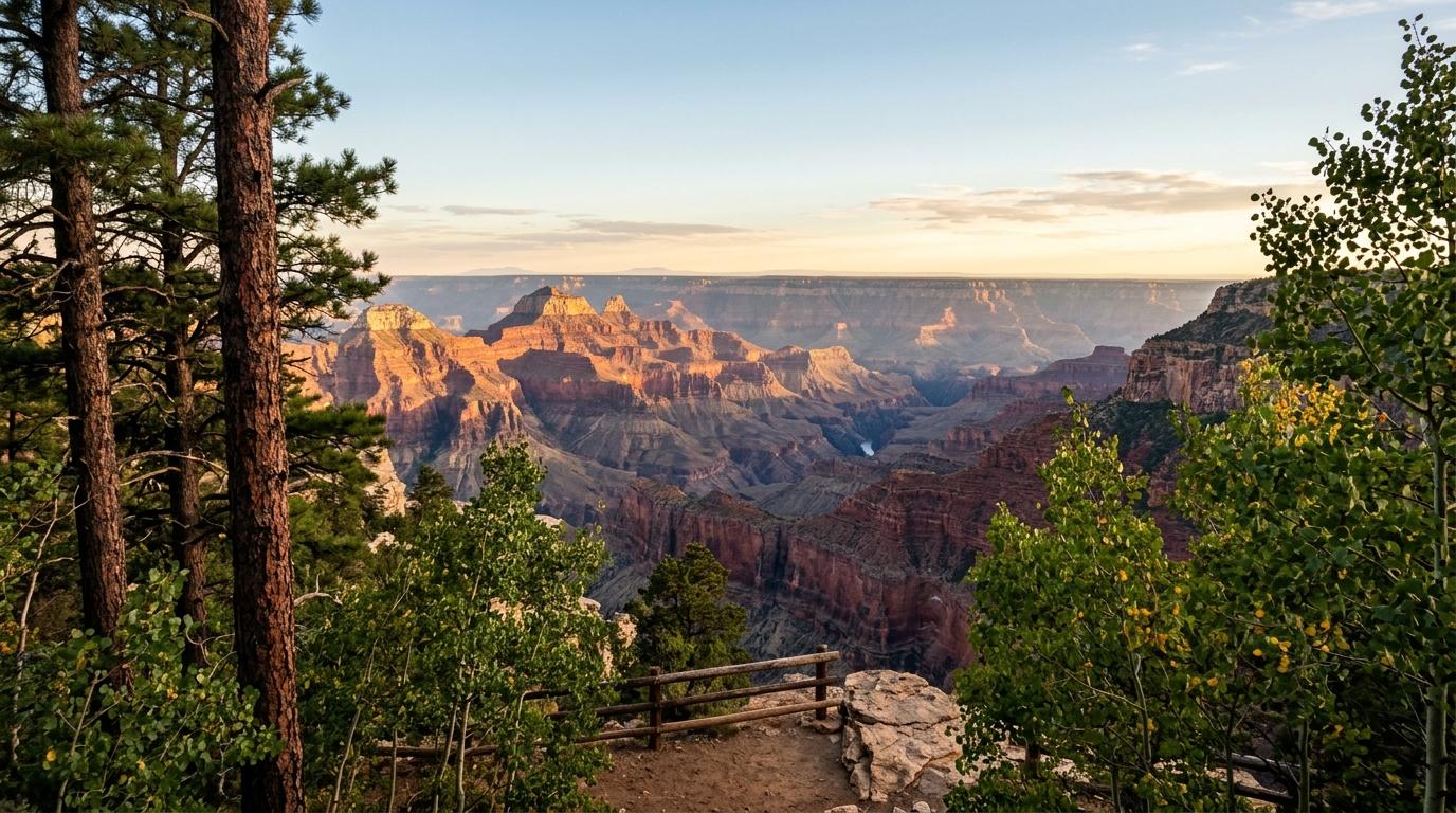
The North Rim looks south across a narrower, steeper landscape. Because the North Rim is higher up, you look down into dramatic tributary side canyons that slice deep into the rock. 
The views feel closer, more intimate, and more dramatic. You see sharp spires, sheer vertical drop-offs, and dense greenery clinging to the upper limestone layers.
Top North Rim viewpoints include:
- Bright Angel Point: A paved 0.5-mile trail from the lodge that walks you out onto a knife-edge ridge with sheer drops on both sides.
- Point Imperial: The highest point on either rim at 8,803 feet, looking out over the painted desert and the eastern canyon walls.
- Cape Royal: A scenic 23-mile drive from the lodge that offers the widest panoramic vista on the North Rim, framing Angels Window and distant river views.
For photography, the South Rim gives you epic, classic widescreen vistas with easy shuttle access. The North Rim gives you dramatic cliff drop-offs, golden aspen leaves in autumn, and uncrowded sunset terraces.
Getting Around: Shuttle Buses vs Personal Driving
#How you move through the park is one of the biggest daily differences between the two rims.
The South Rim has one of the best free shuttle bus systems in the entire US National Park network. Once you park your car at your hotel or the visitor centre, you rarely need to drive again. 
Colour-coded shuttle buses run every 10 to 15 minutes along four main routes:
- Village Route (Blue): Connects lodges, campgrounds, the grocery store, and visitor facilities.
- Kaibab Rim Route (Orange): Serves eastern viewpoints like Yaki Point and Pipe Creek Vista.
- Hermit Road Route (Red): Runs along the scenic 7-mile western rim drive, which is closed to private cars from March through November.
- Tusayan Route (Purple): Runs in peak summer to ferry visitors from the gateway town of Tusayan into the park, avoiding vehicle entrance line delays.
The North Rim has zero park shuttle buses. 
There are no public buses connecting viewpoints. You must drive your own car or rental vehicle everywhere you want to go. 
To visit Point Imperial or Cape Royal, you will drive a winding 45-mile round-trip along narrow park roads through the forest. Parking lots at North Rim viewpoints are smaller, but because overall visitor numbers are low, finding a space is rarely a problem.
Lodging and Dining: Town Infrastructure vs Solitary Cabin
#Where you stay at night will shape your entire trip experience.
The South Rim has extensive lodging options, both inside the park and right outside the entrance gates. Inside the park at Grand Canyon Village, you have historic options like El Tovar Hotel (built in 1905) and Bright Angel Lodge, alongside modern motels like Kachina, Thunderbird, and Maswik Lodge. 
If park hotels are sold out, the town of Tusayan sits just 5 miles outside the south gate, offering dozens of brand-name hotels, casual dining, fast food, and petrol stations. Further south, the historic railroad towns of Williams (60 miles) and Flagstaff (80 miles) provide hundreds of budget motel rooms.
The North Rim offers very few beds. 
Inside the park, there is exactly one commercial accommodation: the Grand Canyon Lodge. It features a historic central stone lodge surrounded by rustic log cabins and motel units nestled in the pines. 
These cabins book out up to 12 months in advance the moment reservations open online. If you do not get a room at the lodge, the nearest lodging outside the park is Kaibab Lodge (18 miles north) or Jacob Lake Inn (45 miles north at the junction of Highway 89A). 
Beyond that, you are looking at small motels in Kanab, Utah, which is 80 miles (1.5 hours) away.
Dining follows the same pattern. The South Rim has everything from fine dining at El Tovar Dining Room to casual pizza pubs, food courts, and a full-scale supermarket. 
The North Rim has the Grand Canyon Lodge dining room (which requires advance dinner reservations), a small deli, a coffee saloon, and a rough-and-ready snack bar.
Hiking and Trail Conditions
#Both rims give you access to the inner canyon, but the hikes are not for beginners.
At the South Rim, the two most popular corridor trails are Bright Angel Trail and South Kaibab Trail. 
- Bright Angel Trail begins right next to the village lodges. It is well-maintained, wide, and offers seasonal drinking water stations and rest houses at 1.5 miles and 3 miles down.
- South Kaibab Trail begins near Yaki Point (shuttle bus access only). It follows an open, exposed ridge line with jaw-dropping 360-degree views, but offers zero shade and zero water.
At the North Rim, the primary route into the canyon is the North Kaibab Trail. 
- The North Kaibab Trail is steeper, longer, and more remote than the South Rim routes.
- The trailhead begins at 8,241 feet, meaning you start hiking in thinner mountain air.
- The first 1.5 miles drop steeply down through the Supai Tunnel before reaching Roaring Springs and Ribbon Falls deeper down.
- There are fewer casual hikers on this trail, and returning uphill at high altitude demands serious cardiovascular effort.
Never attempt to hike from either rim down to the Colorado River and back in a single day. Heat stroke and dehydration are serious risks, and park rangers rescue hundreds of exhausted hikers every summer.
Gateway Cities and Flight Connections
#Which rim makes sense also depends on where your road trip starts.
If you are flying into Phoenix Sky Harbor (PHX), the South Rim is a straightforward 3.5-hour drive (230 miles) north via Interstate 17 and Highway 180 through Flagstaff. If you fly into Las Vegas (LAS), the South Rim is about a 4.5-hour drive (280 miles) east across the Hoover Dam bypass.
If you are planning a broader "Mighty 5" Utah national park road trip visiting Zion, Bryce Canyon, and Capitol Reef, the North Rim fits naturally into your loop. 
From Zion National Park (Springdale), the North Rim is only a 2.5-hour drive (120 miles) through Kanab. From Bryce Canyon, it is about 3 hours (160 miles). 
Flying into Las Vegas and driving up through St. George and Kanab to reach the North Rim is one of the most scenic road trips in the American Southwest.
Summary Comparison Table
#| Factor | South Rim | North Rim |
| :